- Nephi’s drainage master plan to be evaluated with aid of aerial photography
|
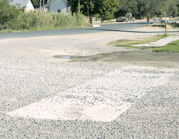
SPEED BUMPS? • No, these drainage ways are a part of Nephi City’s master storm drainage system to carry storm water. Above, a new storm drainage way is being installed at 300 East and 100 South. It channels storm water north to Salt Creek and away from structures.
By Myrna Trauntvein
Times-News Correspondent
There will be public meetings on the Nephi City drainage master plan in the future but much work needs to be done first.
Those meetings will come as the plan progresses, said Randy McKnight, city administrator.
“One of the components of a master plan is aerial photos,” said McKnight. “The photos are best done when the foliage is off of the trees.”
Therefore, the photographs will be taken late this fall so that the trees will be bear allowing better photo resolution.
GIS is another key tool in developing a stormwater drainage master plan.
The purpose of a master plan is to consider various maintenance, repair and design alternatives in order to maximize the capability of the system. The goal is to provide realistic technical solutions that are economically, socially, environmentally and institutionally acceptable to the community.
In order to achieve this goal it will be necessary to first identify the existing stormwater drainage and discharge system in order to evaluate known problems.
The city’s GIS system will be used to analyze watersheds to predict runoff due to past and future urbanization. Slope, soils, impervious surface areas and other parameters are used to model various intensity rainfall events and determine projected flows.
“We have a couple of areas in town where we have problems,” said McKnight. “We do have to look at some concerns.”
Ways to mitigate those problems will be considered and solutions will be developed.
Development of a drainage master plan requires mapping multiple spatial data layers for the entire planning area including parcels, zoning, soils, contours, drainage infrastructure, building footprints, impervious area, streets, creeks, ponds and wetlands.
Digital elevation models and slope class maps are also created.
Watersheds can be divided into sub-basins in order to evaluate the capacity of all drainage infrastructure.
GIS-derived parameters for each urban watershed, such as flow length and gradient, which are a function of a particular rainfall event and time of concentration.
The evaluation of existing capacity compared with the projected increased drainage capacity requirements based upon future growth could be used to form the basis of fees applied to new developments in order to financially prepare for future city-wide infrastructure costs.
Funding for implementation of this plan could be derived from a utility fee assessed each city parcel and determined by the actual square footage of impervious surface.
“Culverts in the city will be identified as part of the master plan,” said McKnight.
|